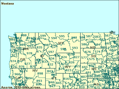
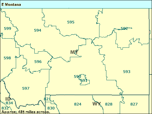
ZCTA maps 500/599
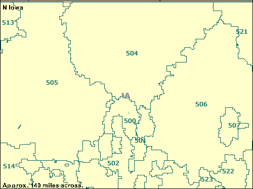
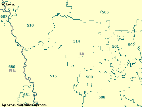
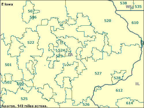
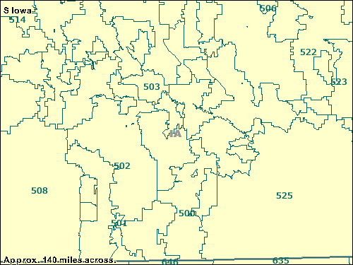
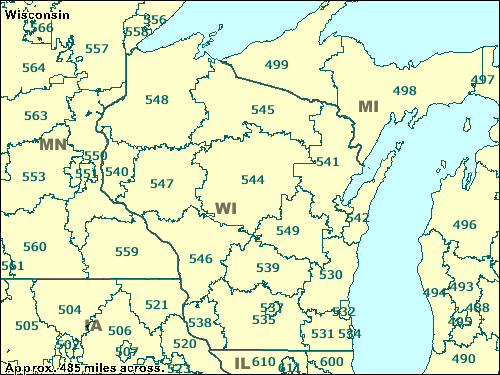
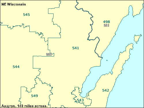
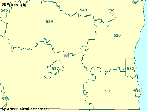
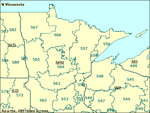
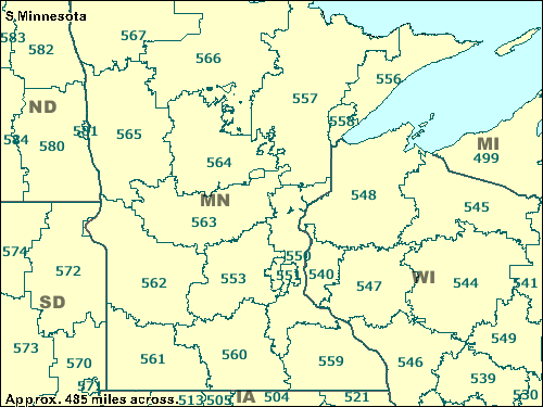
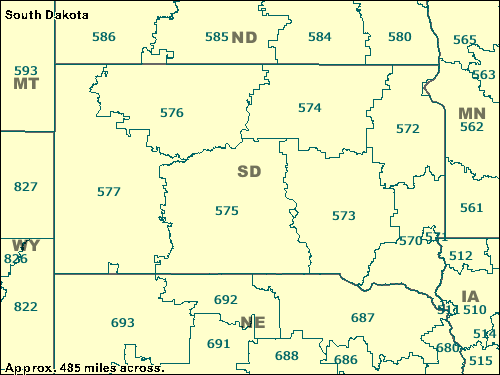
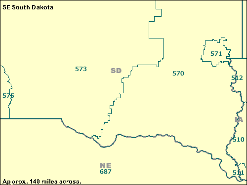
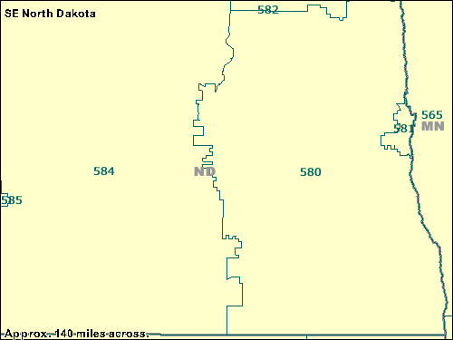
ZCTAs or ZIP Code Tabulation Areas were produced by the U.S. Census Bureau to precisely specify the geographic regions generally served by U.S. Postal Service ZIP codes. The maps from the U.S. Census American FactFinder shade the boundaries and labels of states in gray and the 2000 3-Digit ZIP Code Tabulation Areas in blue-green. On city maps, the purple regions are the 2000 Central City of MSA/CMSA, which are the largest cities of a metro area.
If you know the first three digits of the ZIP Code of a place, these maps will give you a general idea of what region of the state the place is in. For example, given a ZIP Code of 50528, you can use your web browser find feature to look for 505. The browser then locates at least one map that contains the three-digit ZCTA.
IA: 500, 501, 504, 505, 506, 507, 508, 510, 512, 513, 514, 515, 516, 520, 521, 522, 525, 526, 527
N IA: 500, 501, 502, 504, 505, 506, 507, 513, 514, 521, 522, 523
W IA: 500, 501, 502, 505, 508, 510, 511, 514, 515
E IA: 500, 501, 502, 506, 507, 520, 522, 524, 525, 526, 527, 528
S IA: 500, 501, 502, 503, 506, 508, 514, 522, 523, 525
Back to states list
WI: 530, 531, 532, 535, 538, 539, 540, 541, 542, 544, 545, 546, 547, 548, 549
NE WI: 541, 542, 543, 544, 545, 549
SE WI: 530, 531, 532, 534, 535, 537, 538, 539, 542, 546, 549
Back to states list
MN: 553, 557, 559, 560, 561, 562, 563, 564, 565, 566, 567
N MN: 550, 551, 553, 556, 557, 558, 560, 562, 563, 564, 565, 566, 567
S MN: 550, 551, 553, 556, 557, 558, 559, 560, 561, 562, 563, 564, 565, 566, 567
E MN: 550, 551, 553, 554, 560, 562, 563
Back to states list
SD: 570, 572, 573, 574, 575, 576, 577
SE SD: 570, 571, 573, 575
Back to states list
ND: 580, 582, 583, 584, 585, 586, 587, 588
SE ND: 580, 581, 582, 584, 585
Back to states list
MT: 592, 593, 594, 595, 596, 597, 598, 599
E MT: 590, 591, 592, 593, 594, 595, 596, 597, 598, 599
Back to states list
ZCTA maps 600/699
|